GST State Code List and Jurisdiction

GST State Code List and Jurisdiction

Niti Samani
Niti Samani
Table of Contents
Table of Contents

Under the GST taxation system, the state and union territories are represented by their given codes. These codes are mentioned in the GST state code list in numerical form.

The benefit of having short, numerical codes is that it helps in preventing the chaos that arises from writing an alphabetic GST state code in GST invoice and GST return data. This would lead to problems with processing invoices, finding the correct GST liabilities and filing GST returns.

Similarly, the taxpayers can enjoy a lot of transparency after knowing their jurisdiction. They would be able to report their grievances to this jurisdictional officer and even streamline any jurisdictional issues between the center and state.

This article will take you through both- GST state code list and GST jurisdiction list.  

Deskera Books
Get an automated tax complying software for your accounting

Where Do We Need State Code in GST?

In GST, state code is used in:

GST Identification Number (GSTIN)

When getting your GST registration done, it is most likely that you would have received a 15-digit provisional ID or GSTIN. Knowing the structure of your GSTIN is important as this would help you in verifying whether your supplier has quoted the correct GSTIN in their invoices. It is also important as you would then be able to verify that you have mentioned your GSTIN correctly in the invoices to your customers so that you get your input tax credit. The 15 digit of your GSTIN includes:

  • 2 digits signifying the state code
  • 10 digit PAN number
  • 1 digit signifying the number of registrations
  • 2 digits having the default and checksum values

In identifying the “place of supply”

Knowing the place of supply is important to know whether IGST or CGST and SGST will be charged. If the Supplier State Code and “place of supply” state code is different, then IGST would be charged, whereas if the Supplier State Code and “place of supply” state code is the same, then CGST and SGST would be charged.

GST State Code List

Sr. No.

State Name

Alpha Code

GST State Code

1.

Andaman and Nicobar Islands

AN

35

2.

Andhra Pradesh

AP

37

3.

Arunachal Pradesh

AR

12

4.

Assam

AS

18

5.

Bihar

BR

10

6.

Chandigarh

CH

4

7.

Chattisgarh

CG

22

8.

Dadra and Nagar Haveli

DN

26

9.

Daman and Diu

DD

25

10.

Delhi

DL

7

11.

Goa

GA

30

12.

Gujarat

GJ

24

13.

Haryana

HR

6

14.

Himachal Pradesh

HP

2

15.

Jammu and Kashmir

JK

1

16.

Jharkhand

JH

20

17.

Karnataka

KA

29

18.

Kerala

KL

32

19.

Ladakh

LA

38

20.

Lakshadweep

LD

31

21.

Madhya Pradesh

MP

23

22.

Maharashtra

MH

27

23.

Manipur

MN

14

24.

Meghalaya

ML

17

25.

Mizoram

MZ

15

26.

Nagaland

NL

13

27.

Odisha

OR

21

28.

Other Territory

OT

97

29.

Puducherry

PY

34

30.

Punjab

PB

3

31.

Rajasthan

RJ

8

32.

Sikkim

SK

11

33.

Tamil Nadu

TN

33

34.

Telangana

TS

36

35.

Tripura

TR

16

36.

Uttar Pradesh

UP

9

37.

Uttarakhand

UA

5

38.

West Bengal

WB

19

39.

Foreign Country

FC

96

Where Do We Need GST Jurisdiction?

GST jurisdiction plays an important role in the hassle-free processing of the returns, applications, assessments and in availing facilities under the law. The Indian Government has classified the jurisdiction based on the geographical regions, pin codes of distinct locations and distinct districts. A taxpayer must know the jurisdiction he is part of and declare the same while applying for GST registration.

Classification of GST Jurisdictions

GST jurisdictions are classified into 2 main categories:

  • Central Jurisdiction- These are administered by the Center directly
  • State Jurisdiction- These are assessed and administered by the respective state administration

As per the CGST Circular No. 21/2017, dated as 20th September 2017, the prescribed manner in which the Central and State Jurisdictions are demarcated are:

  • 90% of the taxpayers whose total turnover falls below Rs. 1.5 Crore shall vest with the state administration, while the remaining 10% shall vest with the Central administration.
  • On the other hand, 50% of the taxpayers have a total turnover of more than Rs. 1.5 Crore shall vest with the state administration, while the remaining 50% shall be taken up by the center administration.

The division of GST taxpayers is computer initiated and done at the state level using stratified random sampling while taking into account the taxpayer’s geographical location and type of registration. Accordingly, the jurisdictions under GST are classified in order of their hierarchy and size, into the following levels:

  • Zone
  • Commissionerates
  • Division Offices
  • Range Offices

GST Jurisdiction List

State

Zone

Commissionerate Name

Division Name

Range Name and Jurisdiction

Andaman and Nicobar Islands

Kolkata

Haldia

Andaman and Nicobar Islands

Range I: Ward I to VI of Port Blair Municipal Council

Range II: Ward VII to XI of Port Blair Municipal Council

Range III: Ward XII to XVIII of Port Blair Municipal Council

Range IV: Ward- XIX to Ward- XXIV of Port Blair, Municipal Council, Area of South Andaman District outside Port Blair Municipal Council along with entire area of Havelok and Neil Islands

Range V: Entire area of North and Middle Andaman District and Nicobar District and Little Andaman and Nicobar


Andhra Pradesh

Visakhapatnam- Amaravathi

Visakhapatnam

Kakinada Division

Amalapuram: Mandal of Amalapuram, Amalapuram Town, Mandals of AinaVilli, Uppalaguptam, Katrenikona, MummidIVaram, I. Polavaram, Mamidikuduru, Allavaram, Razole, Malkipuram and Sakinetipalle of East Godavari District 

Kakinada Port: Municipal area (1 to 25 Wards) of Kakinada Urban Mandal of East Godavari District Kakinada town: Municipal area (26 to 50 Wards) of Kakinada Urban Mandal of East Godavari District Ramachandrapuram: Mandals of Ramachandrapuram, pedapudi, Karapa, Thallarevu, Kajuluru, Pamarru and Rayavaram of East Godavari District Ramanayyapeta: Area of Kakinada Rural Mandal covered North of Railway line 

Samalkot: Mandals of Samalkot & Peddapuram and Samalkot & Peddapuram Town, Pitapuram, Kothapalle, Kirlampudi, Rangampeta, Gandepalle and Jaggampeta of East Godavari District Tuni: Mandals of Tuni, Tuni Town, Kotananduru, Routhulapudi, Sankavaram, Thondangi, Gollaprolu, Prathipadu and Yeleswaram of East Godavari District Turangi: Area of Kakinada Rural Mandal covered South of Railway line

Arunachal Pradesh

Guwahati

Itanagar

Itanagar Division

Bhalukpung Range: Area covered by entire districts of Tawang, West Kameng and East Kameng of Arunachal Pradesh 

Itanagar Range: Area covered by entire districts of Papumpare, Kurung Kumey, Kra Daadi,Lower Subansiri and Upper Subansiri of Arunachal Pradesh Kharsang Range: Area covered by entire districts of Changlang, Tirap and Longding of Arunachal Pradesh

Namsai Range: Area covered by entire districts of Upper Dibang Valley, Lower Dibang Valley Anjaw, Lohit and Namsai of Arunachal Pradesh Pasighat Range: Area covered by entire districts of West Siang, Central Siang and Upper Siang of Arunachal Pradesh

Assam

Guwahati

Guwahati

Guwahati I Divison

Barpeta Range: Areas under Barpeta District 

I-A Range: Areas under Panbazar PS, Paltanbazar PS & Latasil PS of Kamrup (Metro) District of Assam 

I-B Range: Areas under Fatasil Ambari PS, Bharalumukh PS of Kamrup (Metro) District 

I-C Range: Areas under Gorchuk, Jalukbari & Azara PS of Kamrup (Metro) District 

I-D Range: Areas under Nagarbera PS, Boko PS, Palashbari PS & Chaygaon PS of Kamrup District 

I-E Range: Areas under Hajo PS, Kaya PS & Sualkuchi PS of Kamrup District 

I-F Range: Areas under Baihata PS, Kamalpur PS and Rangiya PS of Kamrup District Nalbari Range: Areas under entire Nalbari District & Baksa District

Assam

Guwahati

Guwahati

Guwahati II Division

Diphu Range: Areas under East Karbi Anglong District 

II-A Range: Areas under Chandmari & Bhangagarh PS of Kamrup (Metro) District 

II-B Range: Areas under Noonmati & Geetanagar PS of Kamrup (Metro) District 

II-C Range: Areas under Pragjyotishpur PS, Satgaon PS & Sasal PS of Kamrup (Metro) District 

II-D Range: Areas under Dispur PS & Hatigaon PS of Kamrup (Metro) District 

II-E Range: Areas under Basistha PS, Sonapur PS & Khetri PS of Kamrup (Metropolitan) District Jagiroad Range: Areas under entire Morigaon District Nagaon Range: Areas under Nagaon District, Hojai district & West Karbi Anglong District

Bihar

Ranchi

Patna I

Gaya Division

Aurangabad Range: Territory under the district of Aurangabad Bhabhua Range: Territory under the district of Kaimur Gaya Range: Territory under the district of Gaya 

Nawada Range: Territory under the district of Nawada 

Sasaram Range: Territory under the district of Rohtas

Chattisgarh

Bhopal

Raipur

Raigarh

Range I: Area of Ambedkar Nagar, Monnet and Nalwa, area of ward No. 24 to Ward No. 48 of Nagar Palika Nigam Raigarh including Patrapali, which includes the area of Bedula 

Range II: Area of Station Para, Nawapara, Bhupdevpur, Ganj, Jagatpur , North Chakradhar Nagar, Area of Ward No. 1 to 23 of Raigarh Nagar Nigam, Area of Kharsia Tehsil and entire Jashpur District Range III: Area of Subhash Chowk, Indira Nagar, Kumharpara , Gharghoda and entire Dharamjaigarh Tehsil Range IV: Madhubanpara, Richapara entire Saranggarh Tehsil, Tamnar Tehsil, Lailung Tehsil, Baramkela Tehsil, Pussor Tehsil Range V: Entire Sarguja, Surajpur Balrampur District and other area of Raigarh Division not specified above

Dadra and Nagar Haveli

Vadodara

Daman

Division IX Silvassa

Range I: Areas of Amli Village covering the area of Raj Industrial Estate, Amli Nazar Industrial Estate and adjoining areas. Areas of Amli Village covering the areas of Amli Industrial Estate, Krishna Industrial Esta te, Silvassa Industrial Co-Op Society and adjoining areas Range II: Amli including Gandhi Gram, Dockmardi, Preeti Industrial Estate Amli and Morkhal Villages Range III: Silli, Umerkui and units situated at Kilvani Road, Mota Randha, Nana Randha & Golanda Range IV: Area of Amli Village covering the areas of Everest Industrial Estate, Pragati Industrial Estate and Electronics Industrial Estate, Saphalia Industrial Estate, Amli Industrial Co-Op. Society, Falandi, Athola Range V: Amli Village covering the area between 66 KVA Road and Delkar Road situated at East of Vapi-Silvassa Road covering the area of Laxmi Industrial Estate, Nandinin Industrial Estate, Himalaya Industrial Estate, Tirupati Industrial Estate, Manek Industrial Estate, Specturm Industrial Estate, Silvassa Industrial Estate and adjoining areas and all other areas of Division-IX which is not expressly covered by any of the Range-I to Range-IV

Daman and Diu

Vadodara

Daman

Division IV Daman

Range I: The area situated in kalaria – varkund-Daman, road starting from kalaria out post to Daman College cross road and area of duneth VIllage 

Range II: Area of South side of Road adjacent to RMCL from Basukinath Mandir to Unique Pharmaceutical Laboratories and Glory Polyfilm, Kadaiya and South side of bifurcation of from Basukinath Mandir to Coast Guard Public School (Kg. Section) running through City area of Nani Daman 

Range III: Area of south side of Road from Basukinath Mandir to Coastal Highway (from Plastiblends India Ltd.(Unit-2) to Panama Petrochem) covering north side of coastal highway up to Polycab wires Pvt. Ltd. (Unit-III) and Jayjee Poly Plast to Plastiblends India Ltd (Unit-2), Kadaiya Range IV: Area of North side of Basukinath Mandir up to Nelson Global Products, left side of road starting from Nelson Global products to Air port Road, confining area by air port road up to Basukinath Mandir Range V: Area of left side of road from Multibase India Ltd. to Coastal Highway, right side of Road from Multibase to Air port Road, up to Ajay Packaging, Sovering Pharma confined by Coastal Highway

Delhi

Delhi

Delhi South

Connaught Place

Range 46: Areas namely Connaught Place Block A to E & Palika Bazar falling under Postal Pin code 110001 

Range 47: Areas namely Connaught Place Block F to G, Kasturba Gandhi Marg, Tolstoy Marg, Barakhamba Road under Postal Pin Code 110001 

Range 48: Areas namely Connaught Place Block H to J, Janpath, Akbar Road, KG Marg, Tilak Lane, Tilak Nagar falling under Postal Pin code 110001 

Range 49: i) Areas namely Connaught Place Block K to M, Sansad Marg, Baba Kharagsingh Marg, Bhagat Singh Road, Ashoka Road falling under Postal Pin code 110001 II) Areas falling under Postal Pin code 110069 Range 50: i) Areas falling under Postal Pin codes 1100004 & 110011 II) All other areas falling under Postal Pin code 110001 not covered in Range 46, 47, 48 & 49 above

Gujarat

Ahmedabad

Gandhinagar

Gandhinagar

Range I: Area coming under Sector-15, Sector-25 and Sector 26 including GIDC of these sector of Gandhinagar city (Gandhinagar Municipal Corporation limit) 

Range II: Whole of Gandhinagar city (Gandhinagar Municipal Corporation limit) except sector 15, 25 & 26 GIDC Estate of Gandhinagar City, Gandhinagar 

Range III: Whole of Gandhinagar Taluka excluding area of Gandhinagar city (Gandhinagar Municipal Corporation limit) including Chandkedha and Area from VaishnodeVI circle to Gandhinagar Municipal Corporation limit 

Range IV: Jurisdiction over whole of Dehgam Taluka, of Gandhinagar District Range V: Jurisdiction over whole of Mansa Taluka of Gandhinagar District

Haryana

Panchkula

Gurugram

Division North - I

R-1: Electronic City, Udyog Vihar Phase-IV, Maruti Joint Venture(MJV) Complex and adjoining road 

R-2: Sector-18, Sirhol and HSIIDC (Except MJV) and adjoining road R-3: Sector-17, Sukhrali and adjoining road and Area starting from left side of Gausahala Market and coming to this point Via Sector-12, Atul Kataria Chowk, RajIV Nagar, Prem Nagar and area opposite Bus stand R-4: Area on right side starting from Mahabir Chowk and coming back to this point Via Atul Kataria Chowk, Sector-14, Maharana Partap Chowk, Old DLF and Old MG Road (Opp. Govt. Girls College), Area Starting from ITI(Red Light) and coming back to this point Via Maharana Partap Chowk, Opp. Signature Tower (Red Light) including IDC R-5: Area of the right side of road starting from RajIV Chowk and going upto Government Girls College (Red Light) and coming back to starting point Via Gurudwara Road, Shama Tourist Complex, Mahabir Chowk, Old MG Road upto Government Girls Collage, Chander Nagar, 32nd Mile Stone, Sector-15 Pt-I & II 

R-6: Area on the left side of the road starting from Municipal Committee and coming back to starting point Via post office, Jaccumpura Road, Sohna Chowk , Sidheswar School and Ghanteshwar Mandir R-7: Area on the left side of the old Rly Road starting from 4 & 7 Chowk and coming to this point Via Kabir Bhawan, Jaccumpura Road (Opp. Nai Basti), New Railway, Lal Nursing Home, Bhim Nagar

Himachal Pradesh

Chandigarh

Shimla

Shimla

Range-Shimla-I: Municipal limits of Shimla Municipal Corpn Range-Shimla-II: Outside the Municipal limits of Shimla Municipal Corp., District Kinnaur & Spiti division of Lahaul & Spiti District Range-Solan-I: Municipal limits of Solan Municipal Corpn Range-Solan-II: Outside the Municipal limits of Solan of Tehsil Solan, Tehsil Arki and Tehsil Kandaghat of Solan District

Jammu and Kashmir

Chandigarh

Jammu

Srinagar

Range-I: Physical boundaries of districts of Srinagar, Budgam & Ganderbal Range-II: Physical boundaries of districts of Baramulla, Bandipora and Kupwara 

Range-III: Physical boundaries of districts of Anantnag & Kulgam Range-IV: Physical boundaries of district of Shopian and Pulwama 

Range-V: Physical boundaries of districts of Leh and Kargil of Ladakh Region

Jharkhand

Ranchi

Ranchi

Ranchi South Division

Gumla Range: Area covering the entire Gumla and Simdega districts 

Range-I: Area covering Kanke, Gonda & Pithoria Police Stations in Ranchi district Range-II: Area covering Lalpur Police Station in Ranchi district 

Range-III: Area covering Tatisilwai, Angara, Silli, Muri, Bundu, Sonahatu & Tamar Police Stations in Ranchi district Range-IV: Area covering Chutia, Lower Bazar Thana & Namkum Police Stations in Ranchi district 

Range-V: Area covering Hindpiri & Daily Market Police Stations in Ranchi district 

Range VI: Area covering Jagannathpur, Pundag, Doranda & Argora Police Stations in Ranchi district Range VII: Area covering Nagri P.S., Lapung P.S., Bero P.S., Itki P.S., Dhurwa P.S. & Tupudana P.S. in Ranchi district and the entire Khunti districts

Jharkhand

Ranchi

Ranchi

Ranchi North Division

Daltonganj Range: Area covering Palamu & Garhwa districts Lohardaga Range: Area covering Mandar P.S., Narkopi P.S. & Chanho P.S. in Ranchi district and entire Lohardaga district 

Range-I: Area covering Khalari P.S., Burmu P.S., Ratu P.S. & Mackluskiganj P.S. in Ranchi district and entire Latehar district Range-II: Area covering Bariatu P.S., Sadar P.S., Ormanjhi P.S. & Sikidiri P.S. in Ranchi district Range-III: Area under the jurisdiction of Kotwali Thana, Ranchi consisting of: Area covering Cart Sarai Raod starting from Bal Krishna High School to Shaheed Chowk and on Kutchery Road from Shaheed Chowk to Albert Ekka Chowk and then Old H.B. Road towards Lalpur Chowk in the North. Area falling under J.J.Road starting from Bal Krishna High School and towards Bada Talab Park in the West 

Range-IV: Area under the jurisdiction of Kotwali Thana, Ranchi consisting of: Area covering Kutchery Road starting from Shaheed Chowk towards Kutchery Chowk through D.C. Office and then Radium Road towards S.S.P. Residence in the West 

Range-V: Area under the jurisdiction of Sukhdeonagar P.S., Kotwali Thana, Ranchi consisting of: Area covering Cart Sarai Raod starting from Shaheed Chowk through Bal Krishna High School and towards Harmu Bye-Pass Road in the South. Area falling under Kutchery Road starting from Shaheed Chowk towards Kutchery Chowk through D.C. Office and then Radium Road towards S.S.P. Residence in the East Range-VI: Area under the jurisdiction of Kotwali Thana, Ranchi consisting of: Area covering J.J. Road starting from Bal Krishna High School and towards Bada Talab Park in the East. Area falling under Cart Sarai Road starting from Bal Krishna High School and towards Harmu Bye-Pass Road in the North

Karnataka

Bengaluru

Mysuru

Hassan Division

Chikkamagaluru North Range: All areas under Tarikere, Narasimrajapura, Koppa and Kadur Taluks in the revenue district of Chikmagaluru Chikkamagaluru South Range: All areas under Chikkamagaluru, Shringeri and Mudigere Taluks in the revenue district of Chikmagaluru Hassan Central Range: All areas under Hassan and Arakalgud Taluks in the revenue district of Hassan 

Hassan East Range: All areas under Chennarayapatna, Arsikere and Holenarasipura Taluks in the revenue district of Hassan 

Hassan West Range: All areas under Alur, Belur, and Sakleshpur Taluks in the revenue district of Hassan

Kerala

Thiruvananthapuram

Thiruvananthapuram

Thiruvananthapuram South Division

Chalai Range: 695014,695023,695036 

Kattakkada Range: 695124, 695125, 695505, 695512, 695571, 695572, 695573, 695574, 695575 Neyyatinkara Range: 695121, 695122, 695123, 695126, 695132, 695133, 695134, 695501, 695502, 695503, 695504, 695506, 695507, 695508, 695513, 695521, 695523, 695524, 695525, 695526 Pappanamcode Range: 695002, 695006, 695012, 695018, 695019, 695020, 695032, 695040, 695042, 695522, 695528 Statue Range: 695001, 695034 Thiruvallam Range: 695007, 695008, 695009, 695026, 695027, 695527


Lakshadweep

Thiruvananthapuram

Kochi

Ernakulam Division

Kavaratti Range: The area falling under the U.T. of Lakshadweep covering the PIN Codes of 682551, 682552, 682553, 682554, 682555, 682556, 682557, 682558 and 682559

Madhya Pradesh

Bhopal

Bhopal

Bhopal Customs Division

Range-Mandideep-I: Sectors A, B and D of MPAKVN of Old Mandideep Industrial Area and area of Goharganj Tehsil of Raisen District on the right side of NH12 (towards Goharganj) beginning from the Kaliasot RIVer Bridge at the boundary of Goharganj Tehsil upto entire area of Goharganj Tehsil on the right side of the NH12 Range-Mandideep-II: Sectors C of MPAKVN of Old Mandideep Industrial Area and area of Goharganj Tehsil of Raisen District on the left side of NH12 (towards Hoshangabad) excluding area of Range-l as above 

Range-Bhopal: Entire districts of Bhopal, VIdisha, Sagar, Raisen excluding Goharganj Tehsil of Raisen District 

Range-Itarsi: Entire districts of Hoshangabad, Betul and Harda including Budhni tehsil of Sehore district 

Range-Sehore: Entire District of Sehore and Rajgarh excluding Budhni tehsil of Sehore district Range-Gwalior: Entire districts of Gwalior, Shivpuri, Datia, Morena, Sheopur, Guna & Ashok Nagar Range-Malanpur: Entire area of Bhind District

Maharashtra

Mumbai

Mumbai-Central

Division I 400003 400009

Range-I: A-C Range-II: D-F Range-III: G-J Range-IV: K-P Range-V: Q-S Range-VI: T-Z

Maharashtra

Pune

Goa

Division - V

Madgaon-I: All Taxpayers having their name with first Alphabet as A toM covered under PIN codes 403601, 403602, 403707 & 403604 of Salcete Taluka Madgaon-II: All Taxpayers having their name with first Alphabet as N to Z covered under area PIN codes 403601, 403602, 403707 & 403604 of Salcete Taluka Colva: All Taxpayers falling in PIN codes 403713, 403708, 403716, & 403721 of Salcete Taluka Cavelossim: All Taxpayers falling in PIN codes 403724, 403717, 403731,, 403701, 403715, 403725, 403723, 403714 of Salcete Taluka Quepem: All Taxpayers falling in PIN codes 403702, 403703, 403704, 403705, & 403706 and any other PIN code cover under Sanguem, Quepem and Canacona Talukas

Manipur

Guwahati

Imphal

Imphal Division

Churachandpur Range: The entire Districts of Churachandpur & Pherzawl Hill Range: The entire Districts of Senapati, Ukhrul, Tamenglong,Kangpokpi ,Noney, Kamjong & Jiribam 

Imphal-I Range: The entire Districts of Imphal East, Thoubal & Kakching 

Imphal-II Range: The entire Districts of Imphal West & Bishnupur 

Moreh Range: The entire Districts of Chandel & Tengnoupal

Meghalaya

Guwahati

Shillong

Shillong - II Division

Jowai I Range: Entire Municipal area of Jowai Jowai II Range: West Jaintia Hills except areas under Jowai-I Range Khliehriat Range: The Entire District of East Jaintia Hills 

Nongstoin Range: The Entire District of West Khasi Hills & South West Khasi Hills Tura Range: The Entire District of West Garo Hills & South West Garo Hills Williamnagar Range: The Entire Districts of East Garo Hills & North Garo Hills & South Garo Hills

Mizoram

Guwahati

Aizawl

Aizawl Division

Aizawl Range I: The entire Western part of Aizawl District starting from Aizawl-Silchar road Via Durtlang, Bungkawn, Ramhlun & Zarkawt upto Kulikawn following the main road of Aizawl city and the entire District of Kolasib 

Aizawl Range II: The entire Eastern part of Aizawl District starting from Aizawl-Silchar road Via Durtlang, Bungkawn, Ramhlun & Zarkawt upto Kulikawn following the main road of Aizawl city and the entire District of Mamit 

Champhai Range: The entire District of Champhai 

Lawngtlai Range: The entire Districts of Lawngtlai & Saiha 

Lunglei Range: The entire Districts of Lunglei & Serchhip

Nagaland

Guwahati

Dimapur

Dimapur Division

Chumukedima Range: Medziphema ADC Hqrs., Niuland ADC, Chumukedima Town & Peren District 

Dimapur Range I: Entire West from Dimapur Railway Track (DMC Ward-1, 2, 6, 7, 9, 10, 11, 12, 13, 14, 15, 16, 17, 18, 19, 21 & 23) 

Dimapur range II: Diphupar, Dhansiripar Sub-Division (SEZ- Ganeshnagar), Purana Bazar and entire east from Dimapur Railway Track (DMC Ward-3, 4, 5, 8, 20 & 22) 

Kohima Range: The entire Districts of Kohima, Wokha, Phek, Zunheboto & Kiphere Mokokchung Range: The entire Districts of Mokokchung, Mon, Tuensang & Longleng

Orissa

Bhubaneswar

Bhubaneswar

Balasore Division

Balasore I Range: Balasore Tehsil, Bhograi Tehsil of Balasore District 

Balasore II Range: Remuna Tehsil, Basta Tehsil & Jaleswar Tehsil of Balasore District 

Balasore III Range: Soro Tehsil, Bahanaga Tehsil & Nilagir Tehsil of Balasore District 

Balasore IV Range: Oupada Tehsil, Kharia Tehsil, Baliapal Tehsil & Similia Tehsil of Balasore District 

Bhadrak Range: Bhadrak Tehsil, Dhamanagar Tehsil Bhandaripokhari Tehsil & Bant Tehsil of Bhadrak District 

Dhamra Range: Chandabali Tehsil, Basudebpur Tehsil & Tihidi Tehsil of Bhadrak District

Punjab

Chandigarh

Jalandar

Pathankot

Range-I: Geographical area of towns of Sarna, Jhako Lahri, Kiri Khurd, Bamyal, Narot 

Range-II: Geographical area of towns of Sujanpur, Malikpur, Basroop, Bani Lodhi, Madhopur including Defence Road and area surrounding it 

Range-III: Geographical area of town of Chakki, Madauli, Mirthal, Gurh Kalan, Dhar, Dunera, Phongota 

Range-IV: Jurisdiction of Range comprise of municipal limit of Pathankot City of left side of Dalhousie Road while travelling from Amritsar to Dalhousie 

Range-V: Jurisdiction of Range comprise of municipal limit of Pathankot City of right side of Dalhousie Road while travelling from Amritsar to Dalhousie

Rajasthan

Jaipur

Jaipur

GST Division-A Jaipur

GST Range-I: Area of V.K.I. Road No. 1 to 12, Malothra Nagar, RICCO Colony & Eastern part of Road No. 1 to 12 of main Road of RIICO. Area of Division?A which does not pertain to any other Range 

GST Range-II: Area of V.K.I. Road No. 13 to 18, Badharana Industrial Area, Udyog Vihar, Shopping centre, Majdoor Nagar, S.S. Colony,Karni Vihar, Beed Jaisalya, Nilgiri Vistar situated at Jodla, Sahariya colony, Sudamapuri, Harmada and Sikar Main Road, Eastern part upto Harmada Todi Pahadi and all colonies situated in eastern area 

GST Range-III: Area of Sikar Road, Area beginning from right hand side of opposite to V.K.I. Road No. 5 upto Ajmer- Delhi Express Highway (opposite to Road No. 14), Northern area of N.H. 8 which mainly includes ShIV Vihar, ShrinIVas Nagar, Udyog Nagar, Shyam nagar, Shekhawati Nagar, Central Colony, Desh Prem Nagar, Nilgiri Colony, Maliyo ki Dhani, Krishi Upaj Mandi GST Range-IV: Area on Sikar road beginning from express highway upto boundaries of Amer tehsil, Area of Kalwar road beginning from express highway upto northern area of VIllage Kalwar in revenue tehsil Jaipur which includes Macheda, New Loha Mandi, Green Park, Area opposite to Jodla power house which includes Rampuri Dabri, Neendad Benad, Saran Dungar (Jhotwara industrial area ext.), Kardhani, Jalsu, Nangal Jaisa Bohra, Balaji Vihar etc 

GST Range-V: Area beginning from Jhotwara police station Nivaru road in Jhotwara upto crossing of express highway along Sikar railway line, Area beginning from express highway crossing upto express highway crossing at Nivaru road along the Express Highway and Area beginning from Nivaru road crossing upto intermediate area of Jhotwara police station which mainly includes Shops located at both sides of main Nivaru road, Jhotwara Industrial Area, Lakshmi Narayanpuri, Benad road, Dadi Ka phatak, Kamani factory road, Shankar Vihar Colony, Moti Nagar, Jaipuriya textile compound, Hirabadi etc. Shops and colonies located at both sides of area beginning from Sanjay nagar choraha upto 200 ft. bypass which mainly includes Sanjay Nagar A,B,C,D,E, Narayanpuri Roopvarsha Colony, Lakshmi nagar, Uday Nagar etc. Shops and colonies located at both sides of the area beginning from 200 ft. Delhi bypass upto Jhotwara police Station at Nivaru road which mainly includes Jagdishpuri, Bahubali Nagar 21, South Rameshpuri, Ramnewshpuri, Shakti Nagar, Shanti Nagar, Bhim Nagar etc

Sikkim

Kolkata

Siliguri

Gangtok Division

Gangtok I Range: Gangtok PS, Kupup PS, Sherathang PS and North Sikkim District Gangtok II Range: Ranipool PS, Pakhyong PS 

Jorethang Range: All PS under South Sikkim & West Sikkim (except Temi PS and Namthang OP under Namchi PS) 

Rangpo I Range: Rangpo PS, Rhenock PS, Rongli PS Rangpo II Range: Singtam PS, Temi PS & Namthang OP under Namchi PS

Tamil Nadu

Chennai

Puducherry

Karaikal

Karaikal-I: Areas covering Karaikal Municipality and Kottucherry Commune Panchayat 

Karaikal-II: Areas covering Neravy, Nedungadu and Thirunallar Commune Panchayat 

Karaikal-III: Areas covering Thirumalairayanpattinam (T.R.pattinam) Commune Panchayat 

Mahe: Areas covering Mahe Region 

Yanam: Areas covering Yanam Region

Tamil Nadu

Chennai

Chennai Outer

Vellore

Vellore Range: Areas covering Vellore and Anaicut Taluks of Vellore District Katpadi Range: Areas covering Katpadi Taluk of Vellore District 

Gudiyatham Range: Areas covering Gudiyatham and Pernampet Taluks of Vellore District 

Ambur Range: Areas covering Ambur Taluk of Vellore District 

Vaniyambadi Range: Areas covering Vaniyambadi, Thirupattur and Natrampalli Taluks of Vellore District

Telangana

Hyderabad

Hyderabad

Charminar

Chandrayangutta: Ward Nos. 42,43,44 & 45 of GHMC Old Malakpet: Ward Nos. 26 & 27 of GHMC 

Rein Bazar: Ward Nos. 29, 31,36 & 37 of GHMC Saidabad: Ward Nos. 24 & 38 of GHMC 

Santosh Nagar: Ward Nos. 39,40 & 41 of GHMC

Tripura

Guwahati

Agartala

Tripura - I Division

Agartala I Range: From the south side of Howrah Bridge of the Howrah River of Agartala city spreading up to the entire Sepahijala district Agartala II Range: From the south side of Howrah Bridge of the Howrah River of Agartala city spreading up to the entire Sepahijala district

Tripura 

Guwahati

Agartala

Tripura - II Division

Dharmanagar Range: The entire Districts of North Tripura and Unokuti Teliamura Range: The entire Districts of Khowai and Dhalai 

Udaipur Range: The entire Districts of South Tripura and Gomati

Uttar Pradesh

Lucknow

Lucknow

Lucknow IV

Bahraich Range: Whole District of Bahraich

Balrampur Range: Whole District of Balrampur Barabanki I Range: All units under Tehsil Haidergarh and Tehsil Fatehpur. 2. All units under Tehsil Nawabganj, but excluding the units falling on- a. Left hand side of Barabanki Deva Road starting from Railway crossing Gandhinagar Barabanki upto Sharda Shayak Deva Canal, Deva. b. Left hand side of Deva Chinhat Road parallel to the Deva canal and left hand side of Deva Chinhat Road upto Gwari chauraha (4 km milestone on Deva Chinhat Road). c. Left hand side of Gwari sugar mill Road upto Railway crossing Gandhi nagar, Barabanki. Barabanki-II Range: Ramnagar, Sirauli, Gauspur and Ramsanehi Ghat tehsil of Barabanki district.2. Units (in Tehsil Nawabganj) falling on – a. Left hand side of Barabanki Deva Road starting from Railway crossing Gandhinagar Barabanki upto Sharda Shayak Deva Canal, Deva. b. Left hand side of Deva Chinhat Road parallel to the Deva canal and left hand side of Deva Chinhat Road upto Gwari chauraha (4 km milestone on Deva Chinhat Road). c. Left hand side of Gwari sugar mill Road upto Railway crossing Gandhi nagar, Barabanki. 

Gonda Range: Whole District of Gonda 

Shravasti Range: Whole District of Shravasti

Uttarakhand

Meerut

Dehradun

Dehradun

Range-I: Area under Tehsil Mussorie 

Range-II: Area under Selaqui Industrial Area (right side of Chakrata Road) including Tehsil VIkasNagar (except the area covered under Range III at Dehradun), Chakrata, Kalsi, Tyuni of District Dehradun Range-III: Area under Selaqui Industrial Area, (left side of Chakrata Road) including twin Industrial area Camp Road and Langha Road 

Range-IV: Area under Patel Nagar Industrial Area, and Mohbbewala Industrial Area Range-V: Area of Tehsil Dehradun not covered in any other area under GST Division Dehradun

West Bengal

Kolkata

Kolkata North

Central Division

Range-I: Ward No. 39 of Kolkata Municipal Corporation 

Range-II: Ward No. 40 of Kolkata Municipal Corporation 

Range-III: Ward No. 41 of Kolkata Municipal Corporation 

Range-IV: Ward No. 42 of Kolkata Municipal Corporation 

Range-V: Ward No. 43 of Kolkata Municipal Corporation 

Range-VI: Ward No. 44 of Kolkata Municipal Corporation (Assessees starting their Name with alphabet A to L) 

Range-VII: Ward No. 44 of Kolkata Municipal Corporation (Assessees starting their Name with alphabet M to Z)

However, if you are unable to find your jurisdiction through this table, the steps to finding it are given in the next section of this article.

The Process to Know Your GST Jurisdiction

These steps are to be followed on visiting the Central Board of Indirect Taxes (CBIDT) website in order to find which jurisdiction they fall under.

  • Login to the GST CBIDT website and find the “services” tab. Then click on the “know your jurisdiction” button that is visible in the drop-down menu.
  • Select your state from the left column provided on the screen
  • You will be then prompted to select your zone and the commissioner’s office. After you have entered these details, the fields under division and range will be populated.
  • On selecting appropriate options from the drop-down menu, you will get to know your GST jurisdiction.

How Can Deskera Assist You With the Accounting of Your Business?

Deskera Books is accounting software that is dedicated to making accounting easier, hassle-free and error-free for you. It is automatic software that handles all your business accounting be it invoice generation and sending, making of balance sheets, income statement, profit and loss statement, cash flow statement and even bank reconciliation statement.

This is in addition to all the real-time insights and analysis that it provides which will help you to gauge your business performance and decide your further strategies. Deskera Books is equipped to track all your sales, purchases, pending receipts and expected account receivables and account payables.

Deskera Books
Deskera Books

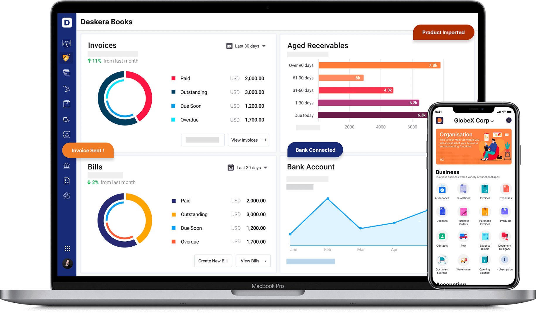
Deskera Books will also help you in keeping track of your financial KPIs and marketing KPIs so that you can optimize your operating income against your operating expenses. This will also help you to identify the marketing strategies and the sales strategies that are working the best for you.

Most importantly, Deskera Books will assist you in complying with all the taxation regimes of the Government where your business is based. So, what are you waiting for? Sign Up for Your Free Trial Now!

Deskera Books
Complying with taxation rules just became a whole lot easier!

Key Takeaways

With the implementation of GST in the Indian taxation system, the whole system has become more automatic, less prone to fraud and more clear. GST state code and jurisdiction list assist further in maintaining this. Knowing your way around GST and acknowledging the benefits of GST will make it easier for you to comply with its requirements.

Comprehensive Checklist of Documents Required for GST Registration
GST is an indirect tax that replaced many indirect taxes such as the exciseduty, VAT, services tax, and so on, with the idea of ‘one nation, one tax’. Thiscame into force in the year 2017. There are four main roles in the society whopay for the GST- A manufacturer, service provider, retailer, and…
How to Check GST Registration Status
The procedure for applying for GST registration[https://www.deskera.com/blog/online-gst-registration] has been made extremelysimple. However, there is some time before you could receive your GSTIN[https://www.deskera.com/blog/what-is-gstinhat-is-gstin…
Guide to GST Portal
Also known as the GST Portal, www.gst.gov.in is the official GST[https://www.deskera.com/blog/gst-india-goods-services-tax/] website of thegovernment that provides various services for taxpayers including providing GSTregistration, filing of GST returns[https://www.deskera.com/blog/step-by-step-guide-for-india-gstr-filing/…
How to Login to the Government GST Portal India?
If you are looking for a place where all the compliance activities of GST canhappen, the GST login portal (www.gst.gov.in) is the answer. It is a websitewhere all the compliance activities of GST[https://www.deskera.com/blog/gst-registration-procedure/] such as GSTregistration, payment of taxes,…
Guide to Online GST Registration
Finding it hard to go through the online GST registration[https://www.deskera.com/blog/how-india-gst-registration/] process? If theanswer is yes, we can help you. Knowing the correct procedure can make the taskeasy-breezy for you. Read this article and get answers to all your questionsrelated to…


Hey! Try Deskera Now!

Everything to Run Your Business

Get Accounting, CRM & Payroll in one integrated package with Deskera All-in-One.

Great! Next, complete checkout for full access to Deskera Blog
Welcome back! You've successfully signed in
You've successfully subscribed to Deskera Blog
Success! Your account is fully activated, you now have access to all content
Success! Your billing info has been updated
Your billing was not updated